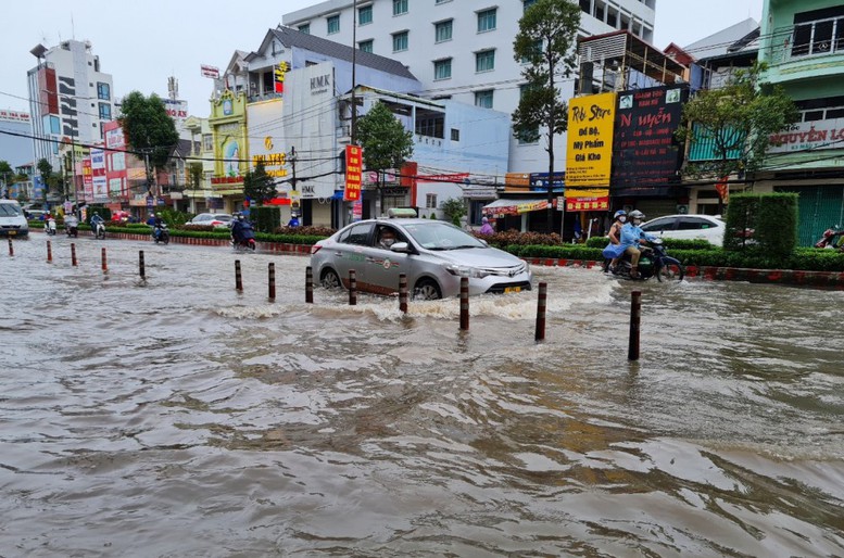
HCMC – The Mekong Delta is bracing for another round of high tides expected to surpass Level-3 flood warnings in the coming days, as floodwaters in upstream areas remain high and heavy rainfall continues to threaten widespread inundation.
According to the Mekong Dam Monitor (MDM), water levels on the Mekong River and Tonle Sap Lake in Cambodia peaked in mid-October, reaching the highest levels in 10 years.
The Southern Institute for Water Resources Planning (SIWRP) said the water level at the Kratie station in Cambodia remains significantly higher than the multi-year average and all recent benchmark years, except for 2011—a major flood year.
In Vietnam, upstream water levels on the Tien River at Tan Chau and on the Hau River at Chau Doc have declined slightly over the past week but remain well above the multi-year and 2024 averages. Persistent high floodwaters combined with recent heavy rainfall have caused embankment breaches in Dong Thap, Tay Ninh (formerly part of Long An), and Vinh Long provinces, damaging large areas of rice fields, fruit orchards, and fish farms.
SIWRP forecasts that rainfall across the lower Mekong Delta basin will remain average next week, while the Mekong Delta will continue to see above-average rainfall.
Around November 3, river levels across the delta are expected to rise again due to a new tidal surge. Water levels in upstream areas are projected to reach Level-1 to Level-2 alerts, with some low-lying stations such as Moc Hoa (Tay Ninh), Truong Xuan (Dong Thap), and Long Xuyen (An Giang) likely to surpass Level-3.
Mid-delta regions could see water levels peak on November 7-8, exceeding Level-3 by 0.1 to 0.3 meters, while the My Thuan station is forecast to reach 2.23 meters—0.43 meters above Level-3.
Coastal stations, including Ca Mau, may record water levels exceeding Level-3 by 0.05 to 0.33 meters, with tides along the western coast expected to peak on November 8-9.
Authorities have urged localities in upstream areas, particularly those in the Dong Thap Muoi subregion of Long An, to closely monitor water levels over the next 10 days. Farmers are advised to regularly inspect embankments and low-lying fields to detect potential breaches early and take timely preventive action.
Meanwhile, mid-delta and coastal provinces—including Can Tho, Vinh Long, and Ca Mau—have been warned to prepare response plans for possible flooding between November 4 and November 9 as heavy rains coincide with rising tides.


