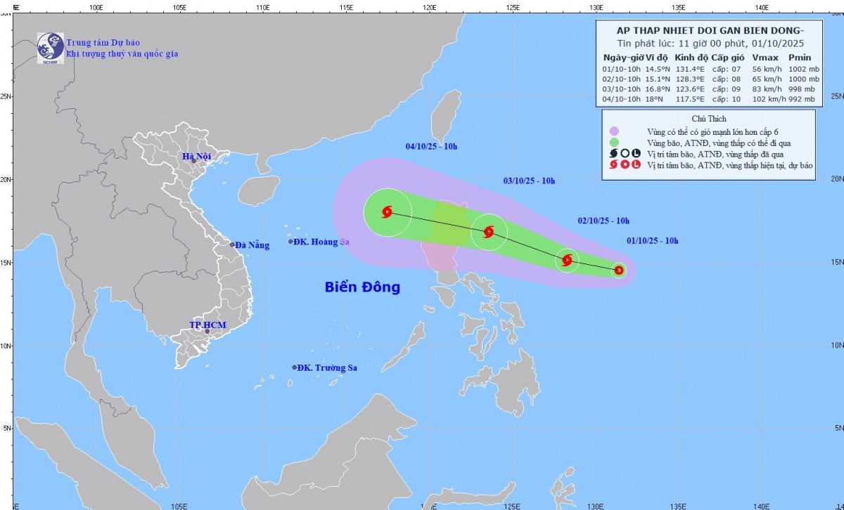
HCMC – A low-pressure system over the waters east of Luzon Island in the Philippines strengthened into a tropical depression this morning, October 1, and is forecast to move into the East Sea, according to the National Center for Hydro-Meteorological Forecasting.
At 10 a.m., the tropical depression’s center was located east of Luzon Island with maximum sustained winds of 39-61 kilometers per hour, gusting at 75 kilometers per hour. It was moving west-northwest at some 15 kilometers per hour.
The weather agency forecast that by 10 a.m. on October 2, the system would continue tracking west-northwest at around 15 kilometers per hour and could strengthen into a storm over the same waters, with wind speeds reaching level 8 and gusts at level 10. By 10 a.m. on October 3, it may further intensify into a storm while moving at 20-25 kilometers per hour, packing winds at level 9 and gusts at level 11.
Over the next 48 to 72 hours, the storm is expected to move mainly west-northwest at 25-30 kilometers per hour, entering the East Sea and likely gaining more strength.
From October 3, the eastern part of the northern East Sea is forecast to experience stronger winds at levels 6-7, with areas near the storm’s center reaching level 8 and gusting at level 10. Waves could rise 2.5-4.5 meters, making the sea rough.
Between October 4 and 6, the northern East Sea, including the Hoang Sa (Paracel) archipelago, could face strong winds of level 10-11, with gusts of up to level 14.Vessels operating in these dangerous waters are warned of thunderstorms, waterspouts, strong winds, and high waves.
Though still off the coast of the Philippines, both Vietnamese and international weather agencies forecast the tropical depression will strengthen into a storm and enter the East Sea.


