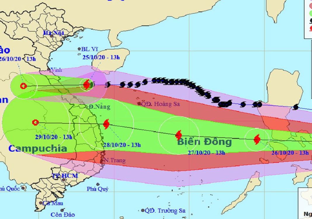
HCMC – Storm Molave is moving westward at 20-25 kph into the East Sea, and is forecast to make landfall in the area from Danang to Phu Yen provinces on October 28, with strong winds at levels 12-13, gusting at level 15.
At 1.00 a.m. today, October 26, the eye of Molave was spotted in the central region of the Philippines, packing gale force winds of 100-135 kilometers per hour, gusting at level 14, the local media reported.
According to the national weather center, the storm will be some 350 kilometers northeast of Song Tu Tay Island at 1.00 a.m. tomorrow, with maximum winds blowing at 115-135 kilometers per hour, gusting at level 14.
In the next 24-48 hours, the powerful storm is forecast to move west-northwest at 20-25 kilometers per hour and may strengthen when heading toward Central Vietnam.
The storm may be centered some 240 kilometers east of the coastal area from Quang Nam to Phu Yen provinces at 1.00 a.m. on October 28.
In the next 72 hours, after hitting the central region, the storm will weaken into a tropical depression. At 1.00 a.m. on October 29, the eye of the storm may be located in the southern region of Laos, with gusty winds at level 8.
Due to the impact of the storm, many parts of the central region of Vietnam will experience torrential rains today, with rainfall measuring 20-50 millimeters.


