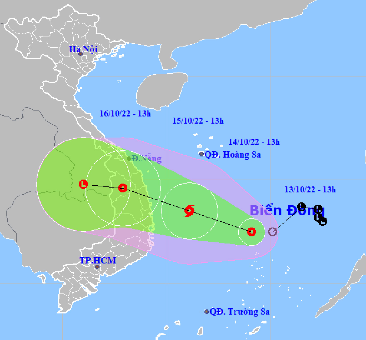
HCMC – A low-pressure area in the East Sea has developed into a tropical depression, which is likely to strengthen into a storm and strike the central coast from Quang Tri to Phu Yen provinces tomorrow afternoon, October 14, according to the national weather center.
As of 1 p.m. today, the tropical depression was spotted some 130 kilometers north of Song Tu Tay Island in Vietnam’s Spratly islands, with winds of around 49 kilometers per hour. The system is moving westward at some 10 kilometers per hour.
By 1 p.m. tomorrow, the tropical depression could be some 190 kilometers from the mainland between Quang Ngai and Binh Dinh. It is expected to move west-northwest at 10-15 kilometers per hour and could strengthen into a storm.
The seas from Quang Tri to Ninh Thuan could experience wind gusts at level 10 and rough seas from tomorrow afternoon.
By 1 p.m. on October 15, the system may maintain the same direction and speed, and slowly weaken into a tropical depression.
The weather center said that high tides and big waves could lash coastal areas from Thua Thien-Hue to Phu Yen and cause flooding in low-lying areas and coastal erosion.
In addition, the central provinces could see downpours from this evening till October 16, with rainfalls ranging from 200 to 500 millimeters.
Local people should watch out for flash floods, landslides, whirlwinds, lightning and strong winds.


