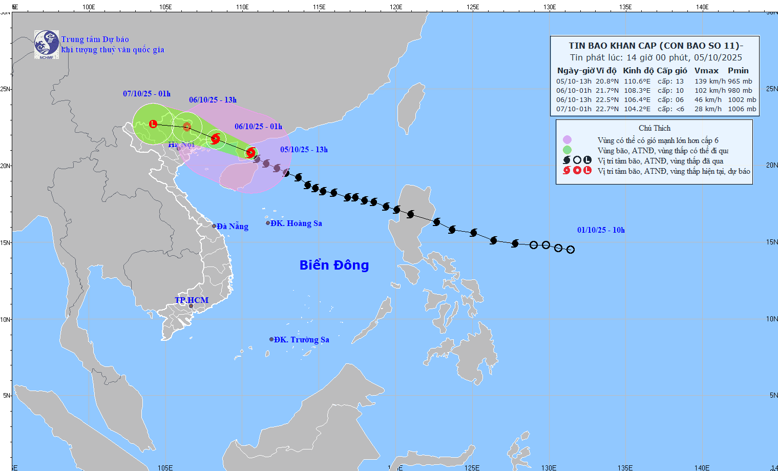
HCMC – Storm Matmo is forecast to make landfall in northern Vietnam this evening, according to the National Center for Hydro-Meteorological Forecasting.
At 2 p.m. today, the storm’s center was about 270 kilometers east-southeast of Mong Cai in Quang Ninh Province, packing winds of 118 to 149 kilometers per hour (levels 12 to 13), with gusts up to level 16.
The storm was moving west-northwest at 20 to 25 kilometers per hour and is forecast to approach the waters off Quang Ninh by 10 p.m. today, with sustained winds of level 11 to 12 and gusts up to level 15.
A level-3 disaster risk warning has been issued for the northwestern East Sea, the northern Gulf of Tonkin, and coastal provinces from Quang Ninh to Hung Yen, including Lang Son Province.
Over the next 24 hours, the storm is expected to continue moving west-northwest toward the Vietnam-China border, with winds weakening to levels 6 to 7 and gusts up to level 9.
By Monday night, the storm is forecast to weaken into a tropical depression as it moves inland over the northern mountainous region.
From tonight through Monday morning, strong winds are expected along coastal areas from Quang Ninh to Hung Yen and in Lang Son Province, reaching levels 6 to 7 and up to 8 to 10 near the storm’s center, with gusts of level 11 to 12. Northeastern inland areas may experience winds of levels 4 to 6, with gusts up to level 8.


