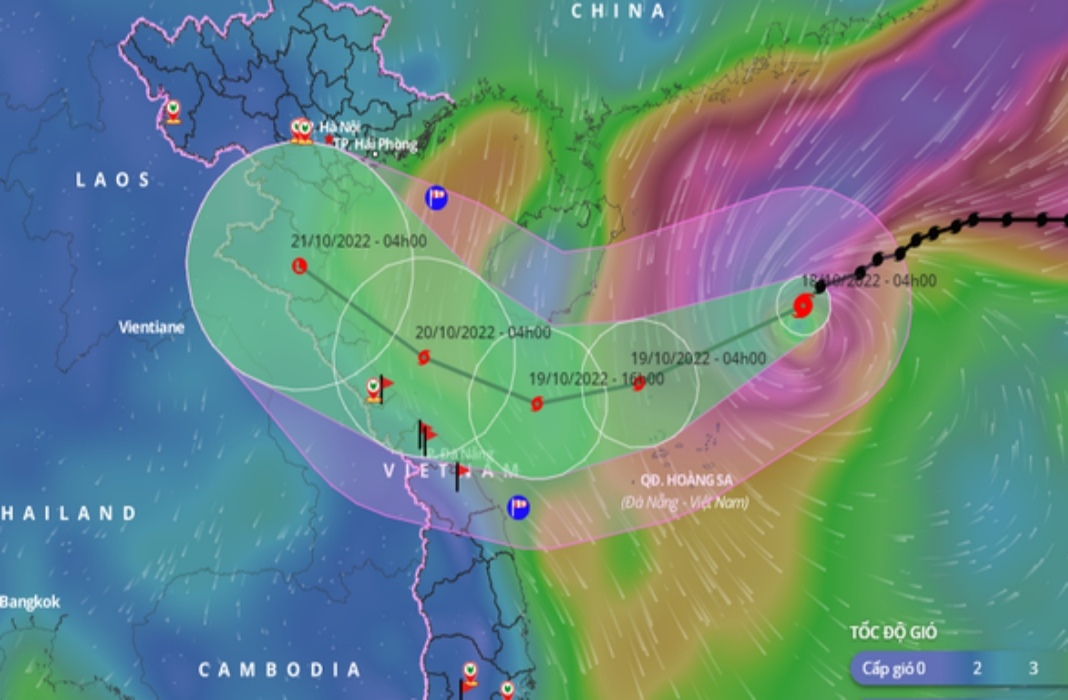
HCMC – Storm Nesat, the sixth to hit Vietnam this year, was spotted 310 kilometers from the nation’s Hoang Sa Islands (Paracels), with winds of 149 kilometers per hour at 7 a.m. this morning, October 18.
The storm has strengthened to level 13 this morning and is moving southwest at 15 kilometers per hour.
By 7 a.m. tomorrow, the storm could be found in the north of Hoang Sa Islands, packing winds at levels 10-11, gusting at level 13, according to the national center for hydro-meteorological forecasting.
The storm is expected to weaken rapidly due to cold air from the north. By 7 a.m. October 20, the storm could be spotted some 120 kilometers north of Quang Binh Province, packing winds at level 7.
The National Center for Hydro-Meteorological Forecasting suggested two possible scenarios for the storm.
First, there is a 60-69% probability that Nesat will weaken into a tropical depression or a low-pressure area before entering the central coast due to the effect of a cold spell from the north.
The second scenario with a 30-40% probability is that Nesat will head to the south of Hainan Island in China, interact with cold air, then weaken and disappear before reaching the mainland.
Due to the impact of Nesat, the waters north of the East Sea, including Hoang Sa Islands, could be hit by torrential rains and strong winds blowing at levels 9-12, gusting at level 14, and rough seas.
Strong winds and heavy rains are expected in the northwest of the East Sea, the Gulf of Tonkin, and the waters from Quang Tri to Quang Nam Province.
According to the National Center for Hydro-Meteorological Forecasting, the East Sea could suffer from three to five storms and tropical depressions until January 2023. Most of them may directly affect the central and southern regions of Vietnam.


