HCMC – A tropical depression in the East Sea is forecast to pick up strength to become a storm early tomorrow, October 13. Meanwhile, central localities are expected to brace for extremely heavy downpours between October 12 and 13.
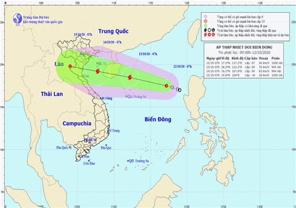
As of 7 a.m. today, the tropical depression was located some 550 kilometers east-northeast of the Truong Sa (Spratly) archipelago, according to the National Center for Hydro-Meteorological Forecasting.
In the next 24 hours, the system will likely move west-northwest at some 20 kilometers per hour before strengthening into a storm.
By 7 a.m. tomorrow, the storm could be centered some 200 kilometers north of the Hoang Sa (Paracel) archipelago, packing strong winds at 60-90 kilometers per hour, gusting at level 11.
The storm will continue to move west-northwest at 15-20 kilometers per hour in the next 24-48 hours and could intensify. At 7 a.m. on October 14, it could be spotted in the sea south of the Tonkin Gulf, with powerful winds blowing at 75-90 kilometers per hour, gusting at level 11.
For the next 48-72 hours, the storm may maintain the same direction at a slow speed of 15 kilometers per hour.
In the mainland, due to the impact of a tropical convergence zone passing through the central region coupled with a cold spell, extremely heavy rains are predicted to batter central provinces and cities including Quang Tri, Thua Thien-Hue, Quang Binh, Danang, with rainfall measuring 200-400 millimeters.


