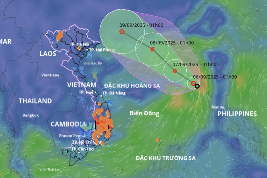
HCMC – A tropical depression in the northern part of the East Sea strengthened early this morning, September 6, and could intensify into the seventh storm of the year in the region, according to the National Center for Hydro-Meteorological Forecasting.
At 7 a.m., the system’s center was located over the northeastern waters of the East Sea, with maximum sustained winds of 50-61 kilometers per hour.
Over the next 24 hours, the tropical depression is expected to move west-northwest at 10-15 kilometers per hour and gradually strengthen. By 7 a.m. on September 7, its center is forecast to be about 430 kilometers east-northeast of the Hoang Sa Islands (Paracels), with winds reaching 62-74 kilometers per hour and gusts of up to 90 kilometers per hour.
Between September 7 and 8, the storm is predicted to track northwestward, intensifying further. By 1 a.m. on September 8, it is expected to be near the coast of Guangdong Province, China, with sustained winds of 75-88 kilometers per hour and gusts up to 100 kilometers per hour, before moving inland.
The tropical depression is already causing rough seas in the northeastern East Sea, with waves of two to four meters and winds strengthening to levels 7-8, with gusts at level 10 on the Beaufort scale.
Scattered showers and thunderstorms are forecast for waters from the central province of Quang Tri down to Ca Mau, as well as the Gulf of Thailand and areas around the Hoang Sa (Paracel) and Truong Sa (Spratly) Islands.
From tonight, heavy rain and thunderstorms are expected in the northeastern East Sea, with the possibility of waterspouts, strong gusts, and waves over two meters.
On September 7, the northern East Sea could see winds of level 7, increasing to levels 8-9 near the storm’s center, with gusts up to level 11 and waves rising to three to five meters, creating extremely rough seas.
Authorities have urged vessels operating in these areas to take precautionary measures as dangerous conditions, including thunderstorms, strong winds, and high waves, are expected.


