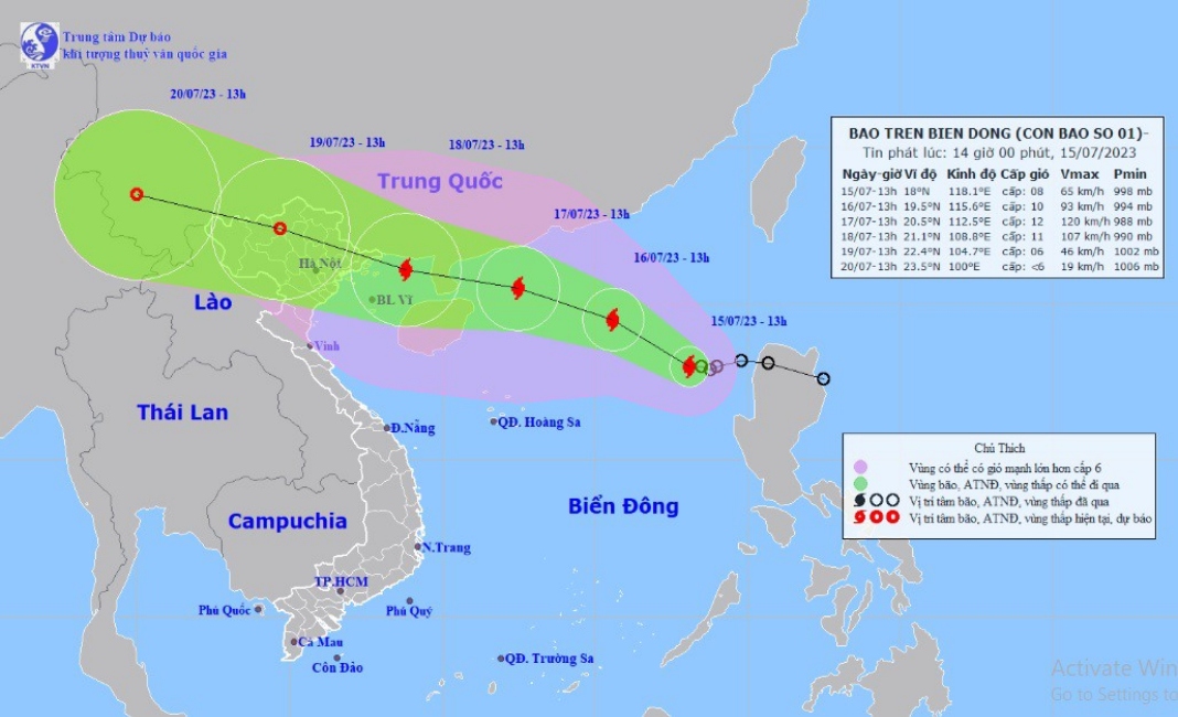
HCMC – A tropical depression active in the East Sea this afternoon, July 15, strengthened into Storm Talim, the first storm expected to hit Vietnam this year, according to the National Center for Hydro-Meteorological Forecasting.
At 1:00 p.m. today, Storm Talim was spotted some 880 kilometers to the east-southeast of China’s Leizhou Peninsula, with a maximum wind speed of 74 kilometers per hour, packing winds at level 8 and gusting at level 10.
The storm is forecast to move northwest at 10-15 kilometers per hour and pick up strength.
By 1 p.m. tomorrow, the storm could be on the northern part of the East Sea, 570 kilometers southeast of Leizhou, packing winds at levels 9-10 and gusting at level 13.
By 1 p.m. July 17, the storm would be 200 kilometers to the east of Leizhou Peninsula. By 1 p.m. July 18, the storm would be above the northern part of the Gulf of Tonkin, blowing at levels 10-11 and gusting at level 13.
The Hong Kong Observatory said the storm’s wind speed will remain at over 140 kilometers per hour until it makes landfall in Vietnam.
Due to the impact of Talim, the northern part of the East Sea will experience strong winds at level 7. The area near the eye of the storm will have winds of level 8, which will later increase to level 9-10, and gust at level 12.
Strong winds and rough waves of 4-6 meters are expected in the eastern part of the East Sea.
The National Steering Committee for Disaster Prevention has requested the authorities from Quang Ninh Province in the northern region to Phu Yen in the south-central coast to monitor the storm and prepare response measures.


