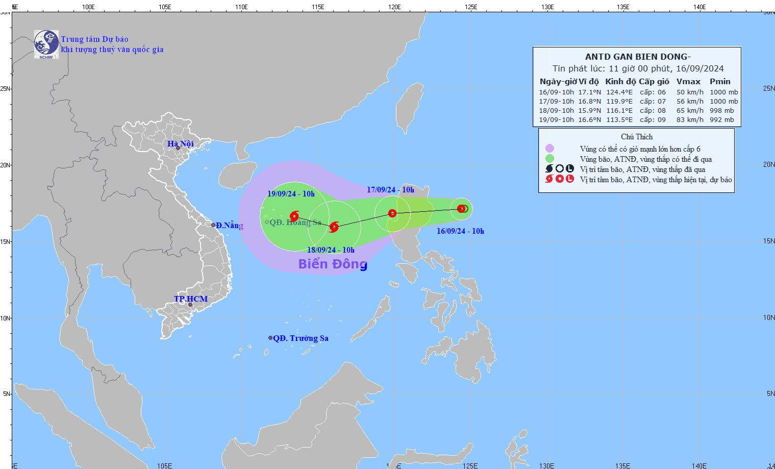
HCMC – A tropical depression has appeared off the coast of the Philippines’ Luzon Island and is expected to intensify into a storm as it moves into the East Sea in the coming days, according to the National Center for Hydro-Meteorological Forecasting.
As of 10 a.m. today, September 16, the tropical depression was spotted east of Luzon Island, with winds reaching levels 6-7, gusting at up to level 9. It is moving westward at a speed of 15 kilometers per hour.
By 10 a.m. tomorrow, the system is forecast to enter the East Sea, continuing its westward path and accelerating to 20 kilometers per hour. Winds are expected to strengthen, reaching level 7, with gusts up to level 9.
By September 18, the depression is predicted to intensify into a storm, around 400 kilometers from Vietnam’s Hoang Sa (Paracel) Islands, with maximum winds at level 8 and gusting at up to level 10. Over the next 48 to 72 hours, it may shift northwest, moving at a speed of 10-15 kilometers per hour.
The eastern waters of the northern East Sea will experience heavy rain on the morning of September 17, with winds reaching level 7 and gusts up to level 9 due to the impact of the tropical depression.


