
Trekking through Tay Con Linh Mountain offers an exhilarating adventure filled with extreme challenges, while showcasing a diverse tropical vegetation, breathtaking waterfalls, and enchanting ancient moss forests.
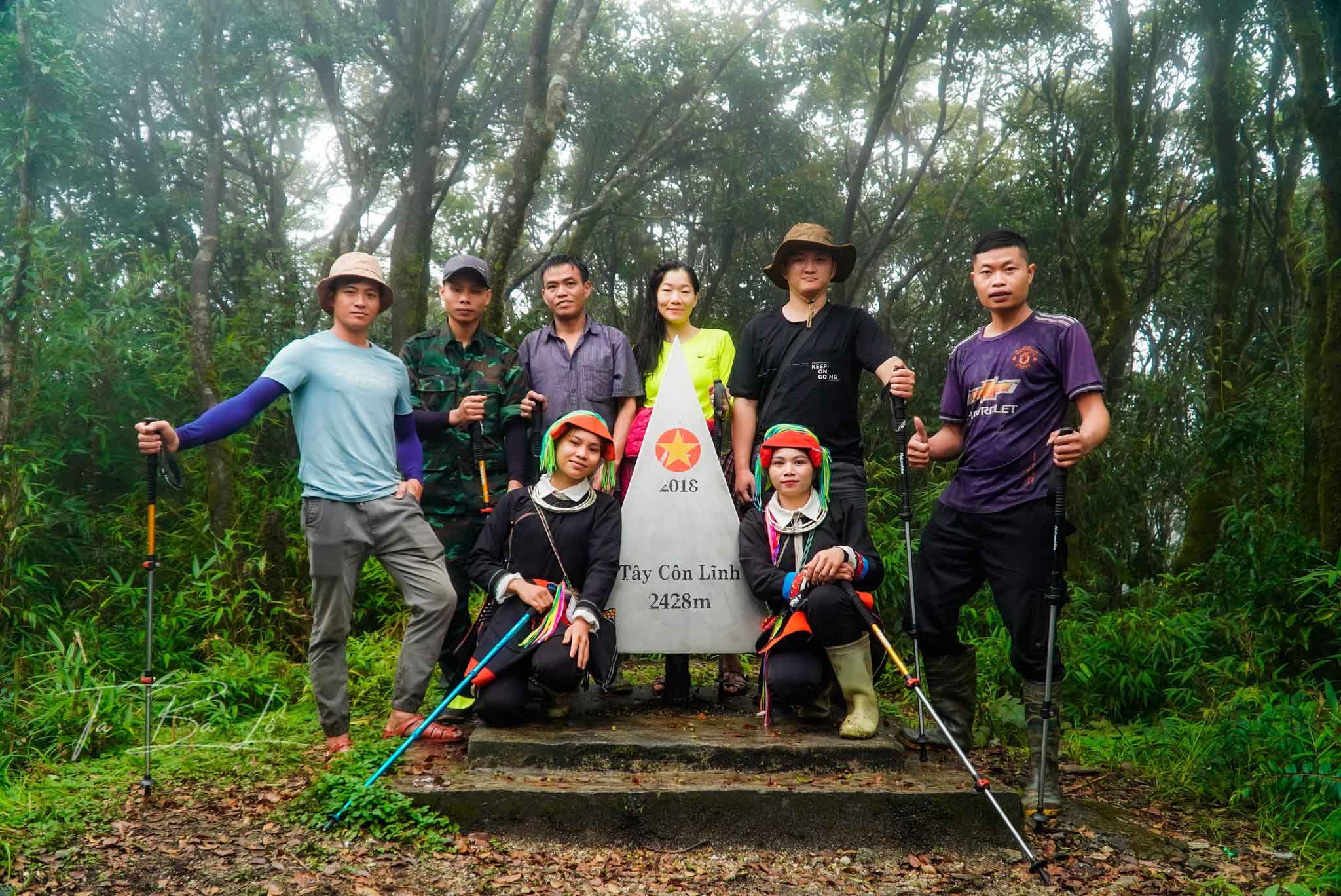
Tay Con Linh Mountain, standing at 2,428 meters above sea level, is often referred to as the “roof of the northeast.” Nestled about 46 kilometers away from Ha Giang City, it spans across Hoang Su Phi and Vi Xuyen districts in Ha Giang Province. The trekking route covers a distance of 17 kilometers, primarily traversing flat terrain. However, the last three kilometers leading to the peak pose a formidable challenge, characterized by rocky terrain, dense forests, and steep slopes, demanding considerable effort from trekkers. The journey is undoubtedly demanding but promises an abundance of unique experiences.
Commencing the trek, travelers must first reach Mao Phin Village. Here, they can soak in the picturesque village landscape, adorned with Dao ethnic houses crowned with moss, ancient Shan Tuyet tea plantations, and grand terraced rice fields. After exploring Mao Phin Village, the journey continues along a 13-kilometer path winding beneath the lush canopy of ancient trees within dense forests, eventually leading to the Tay Con Linh camping site. In this section, trekkers have the option to set up tents for an overnight stay. It is important to exercise caution in this area, as rugged terrain and the presence of reptiles and insects can pose potential risks. Backpackers are advised to carry along insect repellent and avoid excessive movement to ensure their safety.
On the following day, adventurers embark on the final four-kilometer stretch to reach the peak, a journey that takes roughly three hours to complete. As trekkers draw nearer to the summit, Tay Con Linh’s landscapes become increasingly mystical. The temperature gradually drops with altitude, enveloping the peak in cold, foggy, and cloudy conditions. High humidity encourages the growth of moss that blankets trees and vines. Visitors will be utterly captivated by the diverse vegetation, featuring multi-layered tropical primeval forests, rare tree species, golden carpets of fallen leaves, and the harmonious symphony of birdsong echoing throughout the mountains and forests. These factors contribute to the mountain’s allure, shrouded in mist and clouds year-round.
The Tay Con Linh trekking route boasts several slippery slopes, especially during rainy days. The best time to undertake this journey is during the dry season, spanning from September to April of the following year. Given that this is a relatively new trekking area with dense sections, it is advisable for first-time visitors to either hire a local porter or join a guided tour to ensure their safety.