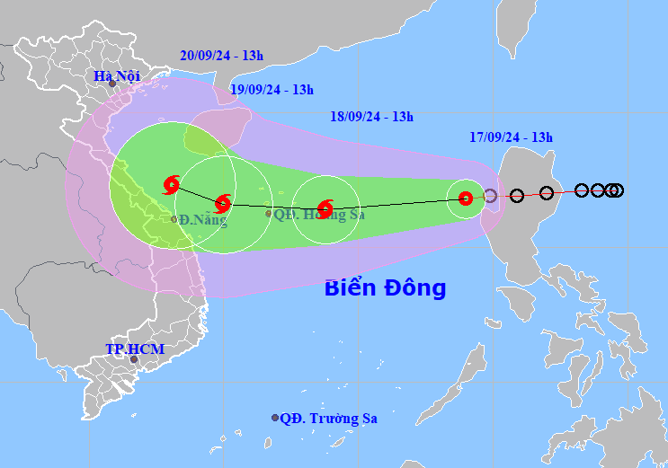
HCMC – A tropical depression near Luzon Island in the Philippines moved into the East Sea this morning, September 17, and is forecast to strengthen into a storm tonight while moving toward the north-central coast of Vietnam.
As of 1 p.m. today, the tropical depression was spotted in the eastern waters of the northern East Sea, around 820 kilometers east of Vietnam’s Hoang Sa (Paracel) Islands. It packs winds at level 7, with gusts up to level 9.
According to the National Center for Hydro-Meteorological Forecasting, the tropical depression is moving west-southwest at about 20-25 kilometers per hour and is expected to continue to intensify into a storm.
By 1 p.m. on September 18, it is expected to be about 240 kilometers east of the Hoang Sa Islands, packing winds at level 8, and gusts up to level 10.
After moving through Hoang Sa, the storm will slow down and move westward, heading towards the central coast of Vietnam. As it approaches the waters near Hue-Danang, the storm may move northwest towards the north-central region.
By 1 p.m. on September 19, the storm will be about 250 kilometers east-southeast of the coastal areas from Quang Binh to Danang. By that time, it will maintain its intensity of level 8-9, with gusts up to level 11. It may then change direction and move northwest at around 10 kilometers per hour.


