Saigon Times Group is a leading Vietnamese media organization with prestigious business and consumer publications. After three decades of development, we have built a good reputation through our publications on economy, business and markets for Vietnamese and foreign readers.
Basic
Free
Free access to daily domestic news, podcasts and videos
Premium
$5 $1 /month (VND 23,900)
MonthlyAnnual
Unlimited access to domestic news, podcasts, videos and magazine articles on current social / economic / trade / investment issues, commodity / financial/securities markets, M&A activity, FDI, local and foreign business communities and more.
Your payment method will then be automatically charged ₫ 899.000 every 365 days thereafter.
Your subscription will continue until you cancel.
You can cancel by using My account. Under My account, select "Unsubscribe" and then follow the instructions to cancel.
You can notify us of your intent to cancel at any time during your billing period. Cancellations take effect at the end of your current billing period.
Located in the northwestern border region of the country, Lao Than Peak (Bat Xat, Lao Cai Province) is a beacon for trekkers, offering a mesmerizing journey through clouds and vistas.
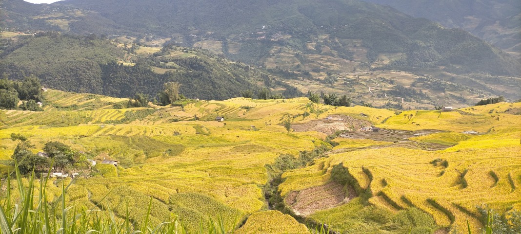
As travelers ascend through the highland commune of Y Ty to conquer Lao Than Peak, the landscape unfolds before them in a spellbinding spectacle.
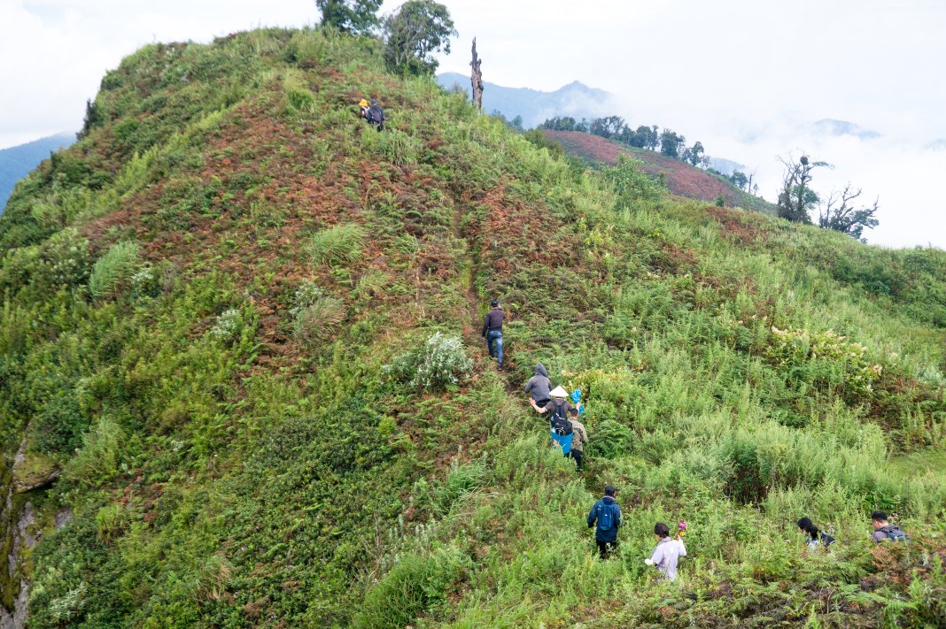
The trail to Lao Than Peak winds through expansive terraced slopes, dense ancient forests, and swirling clouds, captivating all who dare to tread. At 2,800 meters above sea level, adventurers feel as if they were walking on air, seamlessly merging with the heaven and earth amidst the expansive and grandiose panorama, immersing themselves in the natural splendor.
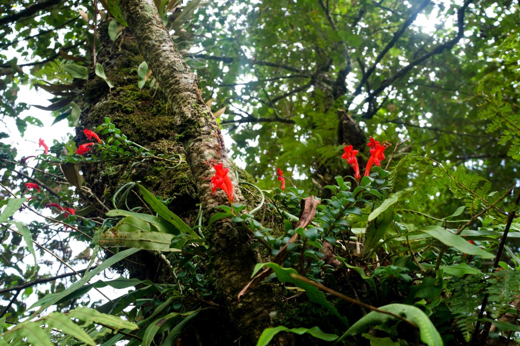
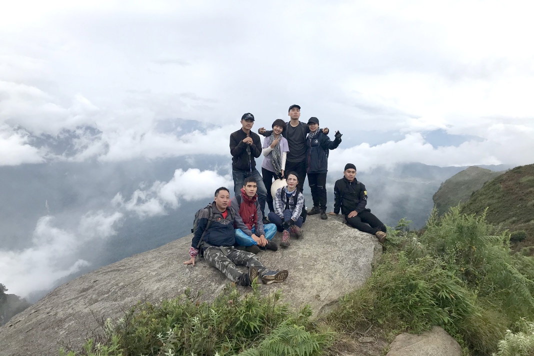
The majestic terraced fields of Y Ty during the ripe rice seasonA herd of goats grazes on the mountainsideTravelers cross the rugged mountain trailThe pristine forests of the Hoang Lien Son Mountain Range with its captivating sceneryThe challenging path requires travelers to pass through thickets and bushesForest flowers beckon travelersThe closer the mountain peak, the more impressive the sceneryTravelers feel as if they were walking among the cloudsThe ethereal sea of cloudsEvenings are spent dining and resting at mountain homestaysCurrently, makeshift sleeping places serve mountain climbersCapturing impressive photographs togetherThe most impressive rock formation near the summit of Lao ThanTaking photos amidst the drifting sea of cloudsLao Than Peak marked with a summit marker indicating an elevation of 2860m