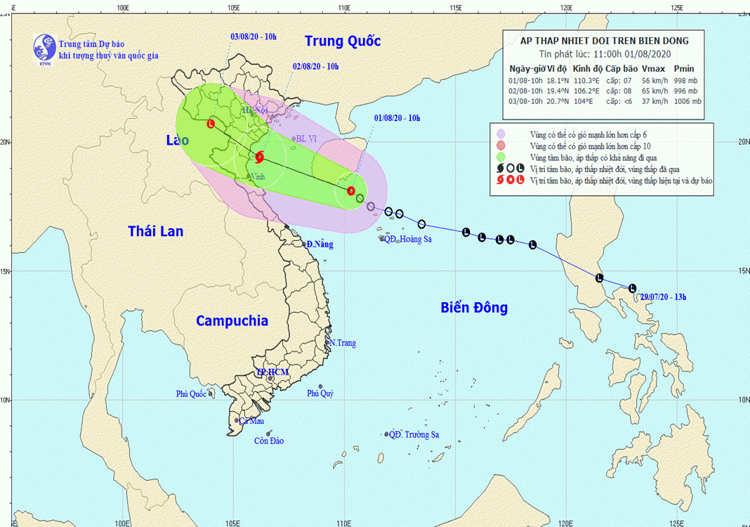
HCMC – Some north-central localities and the northern region are expected to brace for medium to heavy rain from this afternoon until August 5, due to the impact of an intertropical convergence zone and tropical depression, which may strengthen into a storm in the East Sea.
At 10 a.m. today, August 1, the tropical depression was centered in the southeast of Hainan island, packing winds of 50-60 kilometers per hour, gusting at level 9, according to the National Center for Hydro-Meteorological Forecasting.
In the next 24 hours, it may move west-northwest at 15-20 kilometers per hour and will likely strengthen into a storm. As of 10 a.m. tomorrow, the storm could be spotted in the sea of the north-central and northern provinces, with strong winds blowing at 60-75 kilometers per hour, gusting at level 10.
All boats and ships operating in the middle and south of the East Sea may be affected by wind gusts and twisters, noted the center.
From now until tomorrow, twisters, gale force winds and lightning are forecast to touch down in the mainland areas of the northern and central provinces.
In the next 24-48 hours, the storm may continue in the same direction at 10-15 kilometers, making landfall in the north and north-central provinces before weakening into a tropical depression and then a low-pressure area.


