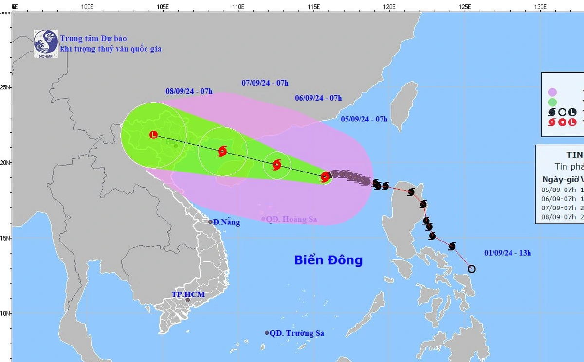
HCMC – Storm Yagi has strengthened into a superstorm, with packing winds of 184-201 kilometers per hour and gusts exceeding level 17, according to the National Center for Hydro-Meteorological Forecasting.
As of 9 a.m. on September 5, the storm’s eye was located in the northern East Sea, with winds at levels 15-16 and gusts above level 17. The storm was moving westward at about 10 kilometers per hour.
By 10 a.m., Yagi had strengthened into a level-16 superstorm and is expected to maintain its intensity as it approaches the eastern coast of Hainan Island (China). It is moving at 10-15 km per hour in a west-northwest direction.
The storm will likely pass between Hainan Island and the Leizhou Peninsula before entering the Gulf of Tonkin between the night of September 6 and the morning of September 7.
By 7 a.m. on September 6, the storm is forecasted to be over the northern Gulf of Tonkin, about 190 kilometers east-southeast of Quang Ninh Province, with wind speeds at levels 13-14 and gusts reaching level 17.
Yagi is expected to make landfall on September 7, impacting coastal areas from Quang Ninh to Ninh Binh.
The northern East Sea will experience strong winds and rough seas, with winds reaching levels 14-16 near the storm’s eye. The Gulf of Tonkin will also see increasing winds from levels 8-9, intensifying to levels 10-12, with severe sea conditions.
Heavy rain is anticipated in the northern and north-central regions from the night of September 6 to the morning of September 9, with rainfall expected to range from 100-300 mm, and some areas seeing over 500 mm.


