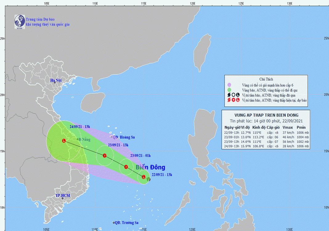
HCMC – A low pressure area is expected to strengthen into a tropical depression in the next 12 hours that could rapidly make its way toward central Vietnam and trigger heavy rain, according to the national weather center.
As of 1 p.m. today, September 22, the low-pressure area was spotted some 180 kilometers northeast of Song Tu Tay Island of the Truong Sa (Spratly) archipelago and could gain strength and become a tropical depression.
In the next 12-24 hours, the tropical depression is forecast to move west-northwest at 15-20 kilometers. By 1 p.m. tomorrow, the system may be some 340 kilometers off the coast of Danang and some 240 kilometers off the coast of Binh Dinh, packing winds at 40-60 kilometers per hour, gusting at level 9.
For the next 24-48 hours, it may maintain the same direction at a slow speed of 15 kilometers per hour, making landfall in the central localities from Thua Thien Hue to Binh Dinh before weakening into a low-pressure system in southern Laos, with winds blowing at below 40 kilometers per hour.
Due to the impact of a tropical convergence zone along with the low-pressure system that could strengthen into a tropical depression and make landfall in the central region, central localities from Ha Tinh to Binh Dinh and the Central Highlands provinces of Kon Tum and Gia Lai are expected to see downpours on September 23 and 24, while Thanh Hoa and Nghe An may experience medium to heavy rain.
Flash floods and landslides could also hit mountainous regions and flooding may occur in low-lying and riverside areas.


