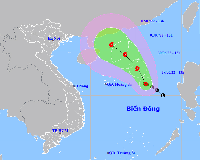
HCMC – A tropical depression active in the East Sea is forecast to strength into a storm in the next 24 hours, according to the national weather center.
By 1 p.m. today, June 29, the tropical depression was spotted some 480 kilometers east of Vietnam’s Hoang Sa Archipelago, packing strong winds at 39-61 kilometers per hour.
The system is forecast to move north-northwest at around 10 kilometers per hour in the next 24 hours. By 1 p.m. tomorrow, it will be some 420 kilometers off the Hoang Sa Archipelago, with winds blowing at around 74 kilometers per hour, gusting at level 10.
In the next 24-48 hours, the storm might mainly move northwest at around 10 kilometers per hour and continue to gain strength.
For the next 72 hours, the storm is predicted to maintain the northwest direction at the same speed and could get stronger.
Due to the unfavorable weather conditions, the East Sea area and the waters from the south-central province of Binh Thuan to Ca Mau Province in the Mekong Delta could see increased strong winds, big waves and rough seas.


